Other Gallery Entries
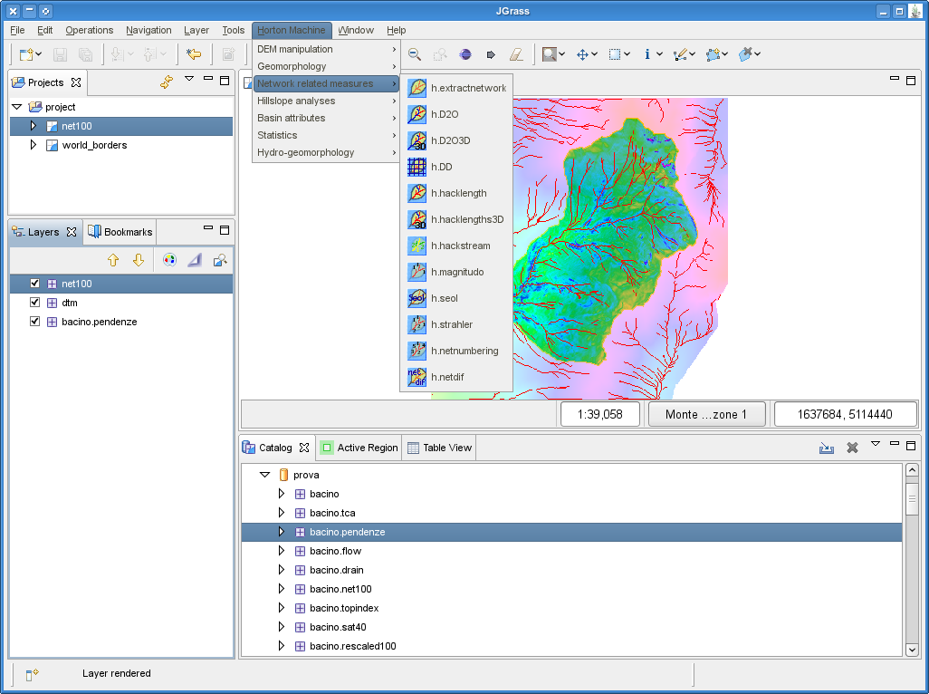
JGrass – Hydrological Modeling in Java
Abstract: JGrass is a free open source GIS based on the uDig framework, built and maintained by HydroloGIS in collaboration with CUDAM. JGrass uses the algorithmic smarts of GRASS and the user-interface of uDig to provide hydrological and geomorphological analyses.
Motivation
The GRASS GIS project is popular among scientists and researchers, for the powerful raster GIS capabilities and different modelling functions that are found in it. However, GRASS is primarily a command-line application still, and many users find it difficult to approach for the first time.
The JGrass project provides a user-interface framework that is compatible with GRASS data and adds some user-friendly features that hydrologists and geomorphologists find useful in their work. Because it is GRASS-compatible, data can be passed back-and-forth with other researchers easily. Because it is graphical, there is a lower barrier-to-entry to start working with the data.

The goals of the JGrass project are:
- portablility, enabling GRASS to be fully functional on the Windows, Unix/Linux and Mac-OS platforms;
- extensiblity, providing a framework for the incorporation of user developed modules to provide specialised functions such as visual representations or graphical interaction with the map data;
- standalone/networked access, allowing standalone operation interacting with local and networked databases, but also allowing remote access to its spatial processing capabilities to enable group interactions;
- scripting, providing a java based scripting engine to allow the development of application scripts; and,
- ease of use, providing all the features common to state of the art GIS applications.
JGrass aims to bring GRASS to production environments as opposed to the research environment. The improved user interface and scripting facility will allow an application oriented user environment focused on the task to be performed.
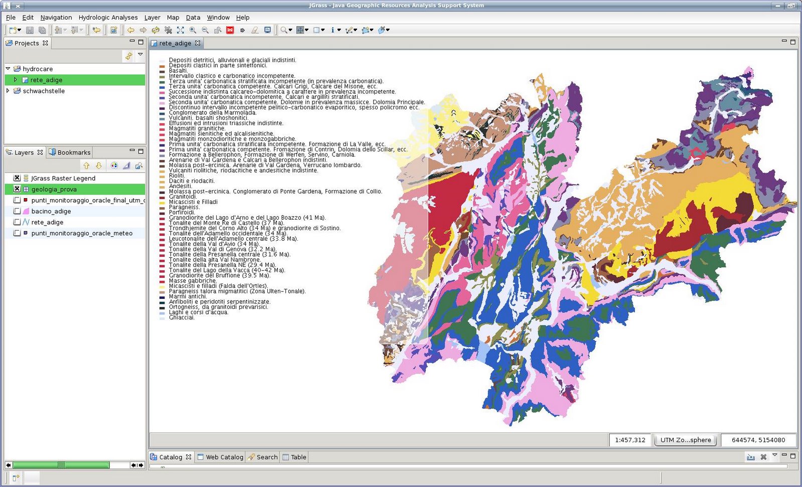

JGrass moved to the uDig platform to add support for vector data and other sources that were not available in the first releases of JGrass.
Rather than duplicate the effort of uDig and GeoTools, the JGrass team chose to focus on the unique parts of their project (tools, algorithms) and get the basic infrastructure (vectors, formats, reprojection, workbench) from the uDig framework.
More Information
About uDig
uDig is an open source desktop GIS application framework, distributed under dual EPL and BSD license.
uDig provides:
- An out-of-the-box application, with the ability to view, edit and print files, database (Oracle, SDE, PostGIS) and Web Feature Servers (WFS).
- An industry-standard extension framework (RCP) for adding new functionality to the application.
- A rich toolkit of Java functionality, ready for developers to build on.
- Native support for Windows, Mac OS/X and Linux.
uDig is developed by a world-wide community of contributors, with an open process and transparent decision making.
About Refractions
Refractions Research is a consulting and systems integration company, with industry-leading exertise in enterprise geospatial applications. Refractions initiated and now hosts the uDig and, PostGIS projects, and continues to provide core development, training and consulting on the projects.