Application Gallery
JGrass – Hydrological Modeling in Java
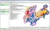
JGrass is a free open source GIS based on the uDig framework, built and maintained by HydroloGIS in collaboration with CUDAM. JGrass uses the algorithmic smarts of GRASS and the user-interface of uDig to provide hydrological and geomorphological analyses.
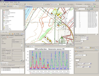
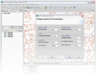
Globema, a Polish-based ICT company, develops and implements OSS/BSS, SmartGrid, DMS/OMS, Network Inventory and Workforce Management solutions for network operators and companies running field works. Using uDig as a framework, Globema has developed ELGrid: an expert system to support development, planning, management and optimization of electric grid..
Globema, a Polish-based ICT company, develops and implements OSS/BSS, SmartGrid, DMS/OMS, Network Inventory and Workforce Management solutions for network operators and companies running field works. Using uDig as a framework, Globema has developed 4RES for forecasting, planning and management support for Renewable Energy Sources.
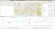
Eurobios – Route Planning and Logistics
Eurobios is a business intelligence company, with a wide range of products and portfolios. Using uDig as a framework, Eurobios has built a routing and logistics package for municipal trash collection programs, the creates optimized routing and schedules for servicing collection areas.
Line Cleaner – BC Ministry of Forests
The BC Ministry of Forests needed a tool to merge multiple road network layers into a single consistent, connected network. The Ministry contracted with Refractions Research to build a merging algorithm and deliver a user-friendly application to run the algorithm using uDig as the delivery platform.
DEWS – Distant Early Warning System for Tsunamis
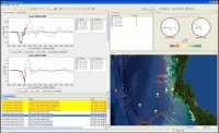
The DEWS (Distant Early Warning System) project, funded under the 6th Framework Programme of the European Union, has the objective to create a new generation of interoperable early warning systems. The principal focus of the project is on tsunamis caused by earthquakes but other geological paradigms are going to follow, e.g. volcanic eruptions or landslides.
Arbonaut – Forest Management Applications
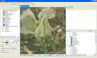
Arbonaut is a Finnish technology company that develops information management and GIS solutions for managing forests and other natural resources. Using uDig as a framework, Arbonaut has built ArboGIS and Taaka, proprietary forest land management applications.
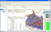
DIVA GIS – International Potato Centre (CIP)
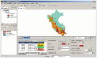
The International Potato Centre (CIP) in Lima, Peru, has used uDig as the framework for their latest release of DIVA GIS, an analytical mapping and data exploration tool for potato genetics. DIVA GIS reads from the CIP genetics database, and allows researchers to explore potential locations for growing and finding new strains of tubers.
About uDig
uDig is an open source desktop GIS application framework, distributed under dual EPL and BSD license.
uDig provides:
- An out-of-the-box application, with the ability to view, edit and print files, database (Oracle, SDE, PostGIS) and Web Feature Servers (WFS).
- An industry-standard extension framework (RCP) for adding new functionality to the application.
- A rich toolkit of Java functionality, ready for developers to build on.
- Native support for Windows, Mac OS/X and Linux.
uDig is developed by a world-wide community of contributors, with an open process and transparent decision making.
About Refractions
Refractions Research is a consulting and systems integration company, with industry-leading exertise in enterprise geospatial applications. Refractions initiated and now hosts the uDig and, PostGIS projects, and continues to provide core development, training and consulting on the projects.