Spatial Toolbox View
The Spatial Toolbox view is used to call processing routines provided by the spatial toolbox.
The Spatial toolbox is a separate process allowing it to work with a wider range of code then we can distribute with the uDig application directly.
Related tasks
Introduction to the Spatial Toolbox
Related concepts
DemManipulation (jgrasstools) Geomorphology (jgrasstools) Network (jgrasstools) Hillslope (jgrasstools) Basin (jgrasstools) Statistics (jgrasstools) Hydrogeomorphology (jgrasstools)
Spatial Toolbox
A tree of style pages for the selected content is displayed. Each page allowing the modification of one aspect of the visualization process.
The style pages used by Map Graphics are each unique; for more information please visit:
View Toolbar
 Consider / Ignore the processing region in the modules
 Stop a running process
 Run the selected module
 Run a script file
 Generate a script without running it
 Open the setting panel
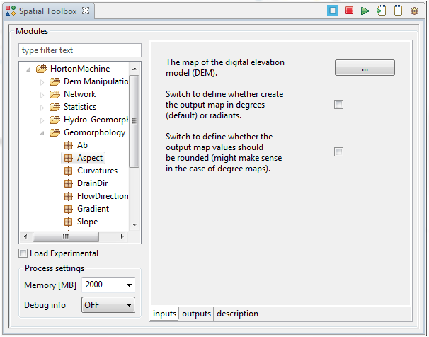
Modules
Displays the list of modules available for your use; you drill down into the tree or type in the filter field to quickly find what you are looking for.
- Load Experimental
Use this checkbox to load additional experimental modules.
Process settings:
- Memory: You can limit the amount of memory used by the module process.
- Debug info: You can control the amount of logging information made available during process execution.
Inputs
The input tab is used to stage the information needed for the process to execute.
Outputs
The results produced by the process.
Description
Description of the process and background information.